Project Overview
To create a series of wayfinding signage that can better help visitors around the campus. With research and rebranding, the wayfinding should help visitors more than the current signage.
Problem Statement
Many students at Sacramento Campus struggle with navigating the college environment, from finding their way around campus to understanding their place in young adult life. Current signage often leads visitors astray, resulting in frustration and delays. The abundance of signage provides limited guidance, leaving individuals to navigate mostly on their own, causing frustration and tardiness.
The problem is to create a new series of signage that better helps visitors on the campus, guiding them around the campus easily and efficiently with little to no pain points in their route.
Solution
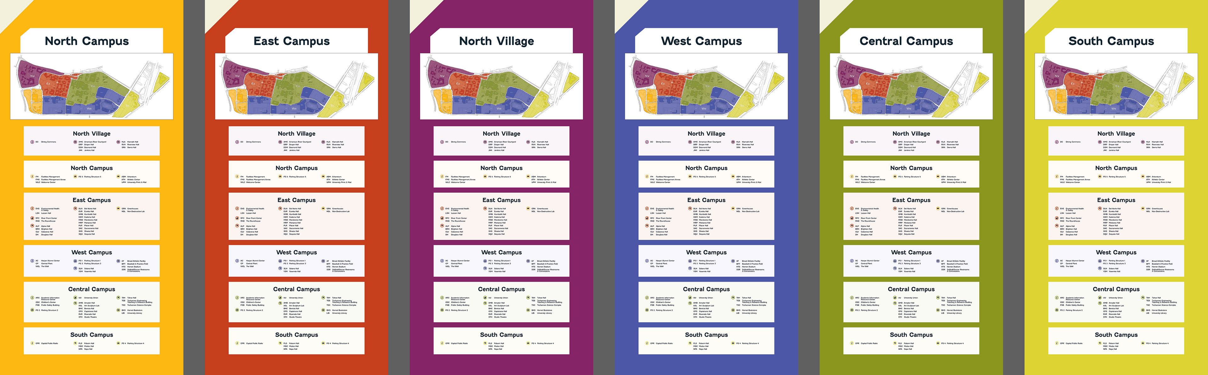
Developing a style of signage based around zoning, where the campus is broken up into six sections and uses color coding and directional arrows around the campus to guide users to the zones. When in the zones, different buildings are listed and how to get to them.
For this series of directional wayfinding, the users must get from the dorms (North Village) to the fitness center (The Well).
Target Audience
The design targets visitors to the campus, primarily students, who vary in age, demographics, and psychographics. Most frequently, these visitors are young adults. The main users of the campus wayfinding system are new students or first-time visitors to CSUS, needing guidance to navigate the campus and its facilities.
Project Duration
5 weeks
Tools Used
Adobe Illustrator
Adobe Photoshop
Microsoft Word
Todoist
Project Scope
Print: wayfinding signage (directional, informational, and map)
Design Process
Discover and Preparation
Site visit
Proto personas
Define
Mood boards
Comparative assessment
Ideate
Sketching
Prototypes
Design
Branding: zoning
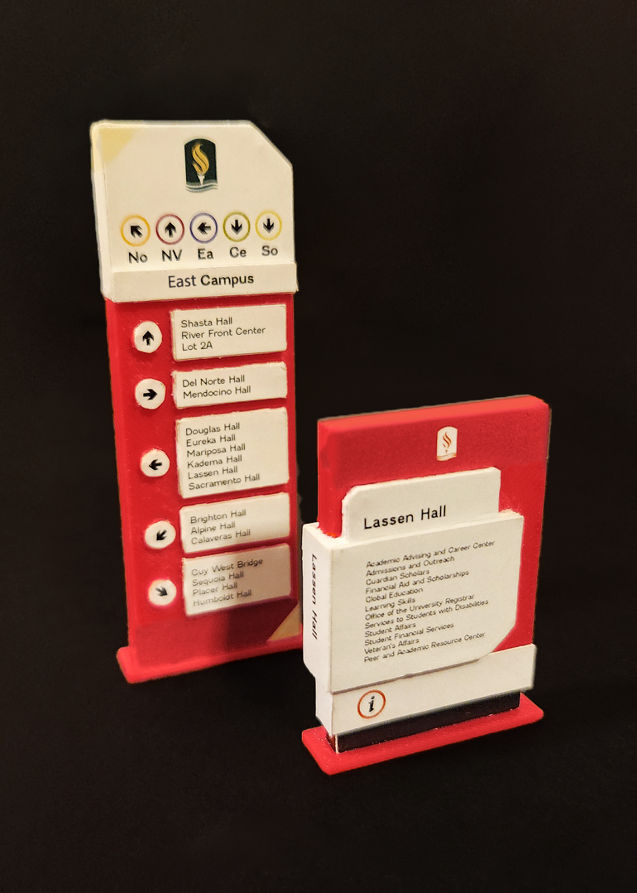
3D printed signs in 1/16th scale, estimated to be 4 in. tall, used as prototypes for the signage
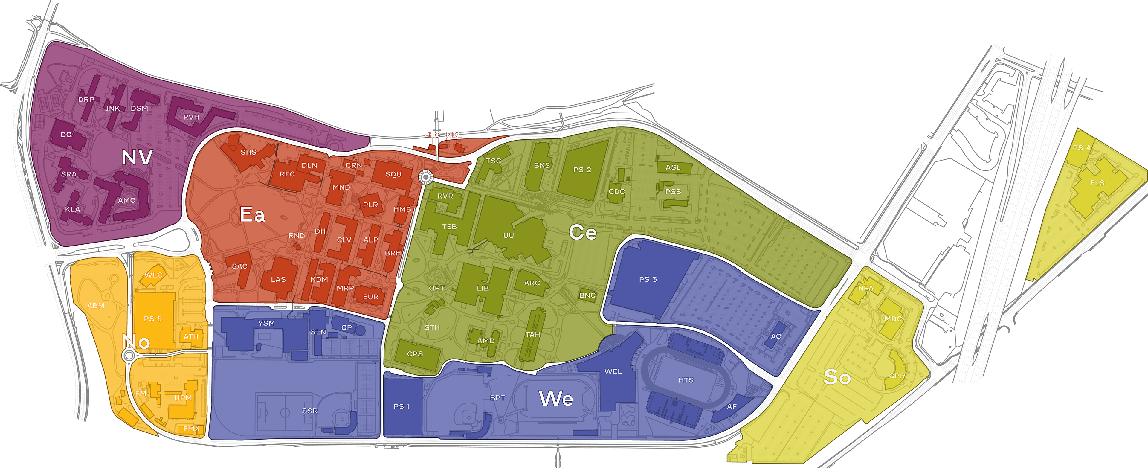
Detailed map of the campus signage, with each zone divided to guide visitors to locations more easily; created in Illustrator from a map of the school
Final Designs
Scope images of the project
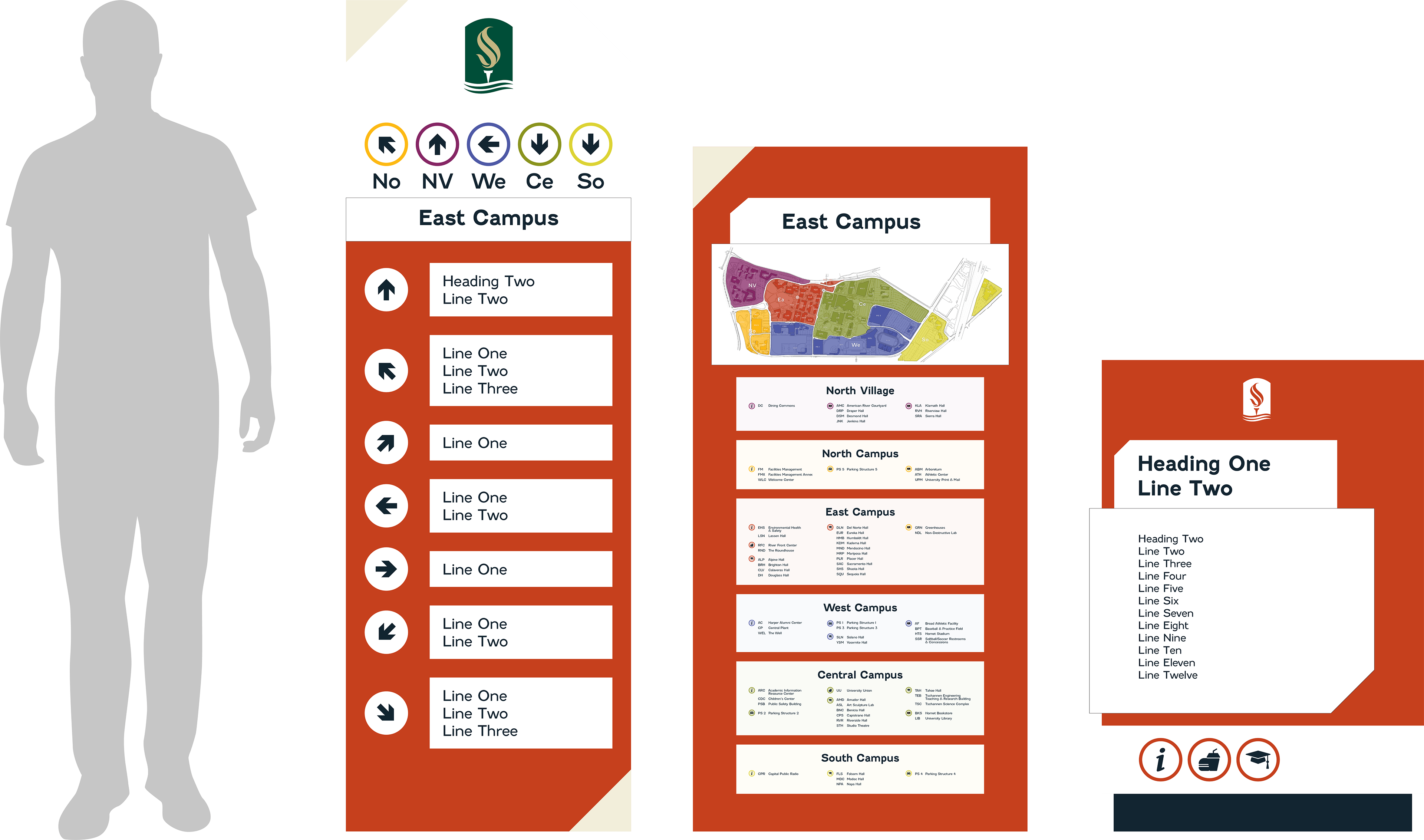
Height of the signage compared to a 6 ft. tall person
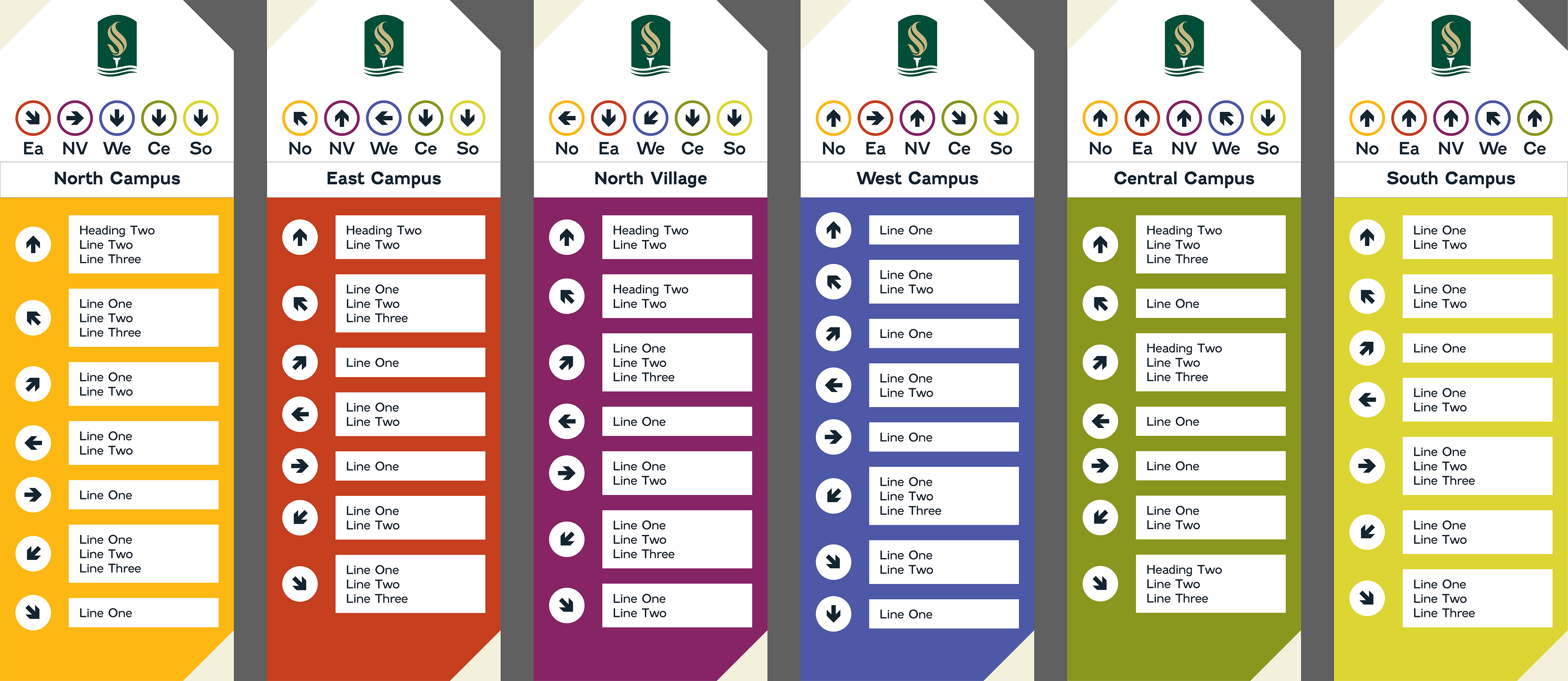
Campus signage – directional (24 x 72 in.)
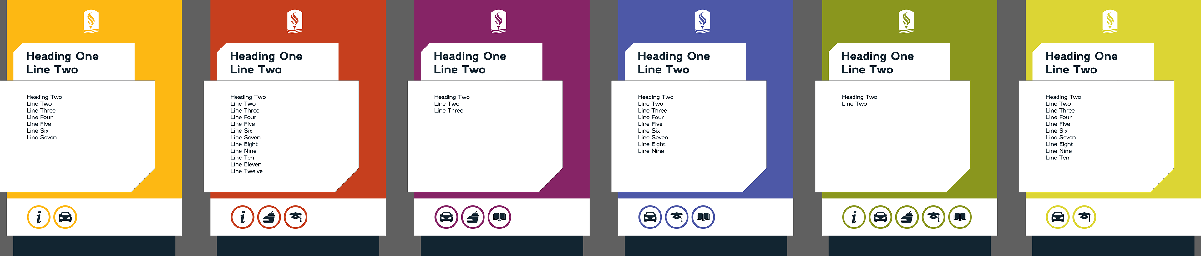
Campus signage – informational (29 x 41 in.)